Why Site Contours from a Survey may say Nothing
Recently I have been having an issue with Levels with Maitland City Council Planners.
Though it was not written in any DCP that was available when I designed the project, the decree seemed to come from on high that no retaining wall should be over 1m. Now, that is a garden wall, you can buy them off-the-shelf. Don't even need an engineer.
I saw the planner using the contour lines on the plan to calculate how high the retaining walls we proposed were. And they calculated some at heights that seemed too high. I knew some of the slope would be taken up in drainage falls. I could not seem to communicate this to the planner. In fact it seemed they were defensive and would not listen to anything I said. The planners said they wanted all the levels at the top and bottom of every retaining wall and fence elevations. They said they would not allow any wall over 1.2m.
The engineer was frankly incredulous. Firstly in the rule for 1m maximum. There was no problem structurally. Give them all the heights? No, they said, retaining walls are ALWAYS determined on site! To give heights could open them to issues of liability. If the site conditions resulted in a change in level and the builder used the design for a lower wall rather than a higher one there could be serious consequences.
And I thought then that if the builder prices it and it was different on site, that is another liability issue, as there may be underpricing or overclaiming by the builder, leading to financial loss by one party to the contract. (Of course if you have an architect administering they will spot the difference and require a variation.)
I felt I could not communicate architectural vision. As a professional I “see†and even “feel†a building in my mind totally before it is built. We had to go to great lengths to give the levels of, essentially, what is dirt to an accuracy of 100mm (the planner concerned was offering a concession at this). Now, if soil is kicked the levels change by nearly that much. In all my +20 years working on building sites the final level on site, more often that not, may be determined by site conditions. If one finds a boulder or hits rock or if an excavation collapses in rain the final level will be varied. One fact that ensures that the level will vary with over-excavation, is that in confined spaces soil cannot be re-compacted to the same strength. In other words, a site condition that results in over-excavation means the footings will change in level. Therefore an 100mm discrepancy in levels is too accurate.
I had an EUREKA moment that explained the issue.
The planner who was assessing the architectural solution kept using the existing RL's to define the retaining wall heights, they even wanted us to re-survey the site. BUT the existing levels say NOTHING about the final levels.
I discovered that the height of a retaining wall cannot be determined by using the existing site levels. In fact it can NEVER be assumed that existing levels from a surveyor's drawing copied straight onto the final architectural drawings have any bearing at all on the final site levels. To determine the height of a retaining wall one must read the elevations and sections where the levels will be shown clearly. And the elevations and sections will only show the levels where the section is cut. The only way to gain a full sense of the varying height of a retaining wall along its length is to take an infinite set of sections along the length of the wall of a 3D model. As anyone who has done calculus knows the infinite can be represented by cuts taken at equal sections along the length.
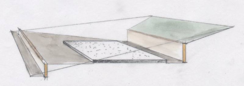
It is very easy to prove, however, that the height of a retaining wall cannot be determined by existing levels. I have set up a 12 degree sloped plane and a floor slab. They are identical in each of the three scenarios below
Site A has no retaining wall,
Site B has two short walls.
Site C has two high retaining walls.
Not one of these walls can be determined by examining the existing slope.
slopesiteC.jpg
Site A: no retaining wall

Site B: short walls
slopesiteA.jpg
Site C: tall walls
The amazing aspect to this was how long it took for the Eureka moment. Firsly we had to redesign. To what Council wanted. Then I had been working off and on with the project for 4 months as it went to and from the engineers as we co-ordinated the stormwater, driveway profiles, structural drawings and architecturals for the 4 houses (to the millimeter). Then after having a break from the drawings to eat lunch on the day I was to hand over the re-designed drawings, the answer was there. The thought just came into my mind seemingly from nowhere.
Existing levels say NOTHING about the final levels.
And without hardly thinking I skecthed in section the three scenarios above.
The planner may have been labouring under a misconception. Certainly, I almost missed finding the cause of the levels issue. The brain is an amazing thing.
- Login to post comments


